Birrarung Marr is a 8.3 hectare park on the north bank of Yarra River, besides Federation Square. It is named in the Woiwurrung language of the indigenous Wurundjeri people, with Birrarung meaning “river of mists” and Marr refering to the side of the river.
Ironically, this site was not on the “side of the river” known by the original inhabitants. The Yarra River flowed through what is now the Botanic Gardens and the ornamental lake there is part of the original river. In the 19th century, the European colonists altered the course of the Yarra River for flood mitigation, thereby creating a new artificial channel flanking the current Birrarung Marr.
History
Originally a marshy site, it was designated for park or ornamental purposes by the colonial government in 1856. However, several institutions including a morgue had already been established there. More were still developed and facilities including the old State Swimming Centre remained until the late 20th century. The first rail line crossed the area in 1859 and railways eventually occupied most of the space between Melbourne’s CBD and the Yarra River. At the end of the 19th century, the Yarra River was straightened, widened and deepened, with tree-lined avenues created along the built-up banks.
In 1992, the Kennett State Government initiated a program on developing central Melbourne, the centrepiece being the building of Federation Square. The infrastructure and land near Federation Square was reorganized. This includes the clearance of the Jolimont railyards and diversion of Batman Avenue away from the river bank to connect to Exhibition Street. These works enabled land to be reclaimed from the former rail yards and roadway, thereby allowing the creation of Birrarung Marr.
The park construction began in 2000, with the City of Melbourne providing $15.6 million to design and build the park and the State Government funding the railway rationalization and site clearance. This park was formally opened to the public on Australia Day, 26 Jan 2002, a hundred years after the last major inner city park, Alexandra Gardens was completed in 1901.
Park Design
Birrarung Marr was envisaged as an active, urban space, catering for community festivals, changing sculpture exhibitions and major events such as Circus Oz and the Moomba Waterfest, while providing for passive recreation at other times. The park is a part of the Capital City Trail, providing a continuous walking and bike path along the Yarra River as well as linking the city centre to the sports precinct (MCG and Tennis Centre) in the south-east. It had received the Walter Burley Griffin Award for Urban Design in 2004.
The design team, which included then City of Melbourne landscape architects Ronald Jones and Helena Piha, and consultants Taylor Cullity Lethlean, Paul Thompson and Swaney Draper, has been disappointed, even annoyed, by the way the park has developed, such as its use as a showgrounds and an event space with the installation of permanent artworks, reducing flexibility of using the space (Ref 1).
Three Level Terraces
Map showing the 3 terraces and various features of Birrarung Marr.
Click on each placemark to view the detail.
View Larger Map
You can download a map of Birrarung Marr here.
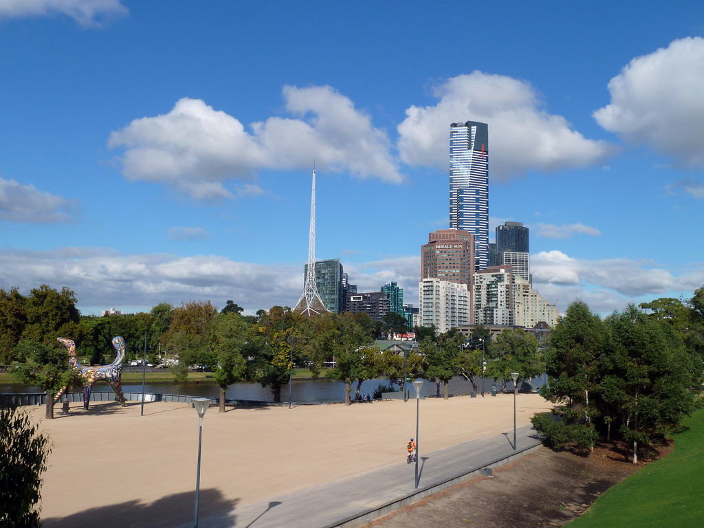
Birrarung Marr was designed as a series of 3 levels open terraces. A large expanse of finely-ground gravel is found on the Lower or River Terrace, which follows the curve of the Yarra River in an easy, level walk from the Princes Bridge to the Swan Street Bridge. The gravel surface serves to cater for major events and to carry the large amount of foot traffic to and from the sports precinct.
The other two terraces have grassed surfaces, although according to the original plan, they were to be forested with trees to provide a place for city workers to visit at lunchtime in the same way they use the Flagstaff and Treasury gardens (Ref 1).
The Middle Terrace, which is on the eastern side adjacent to Batman Avenue, is a functional event space, often the site of temporary facilities for major events at the Melbourne Cricket Ground or Melbourne Park.
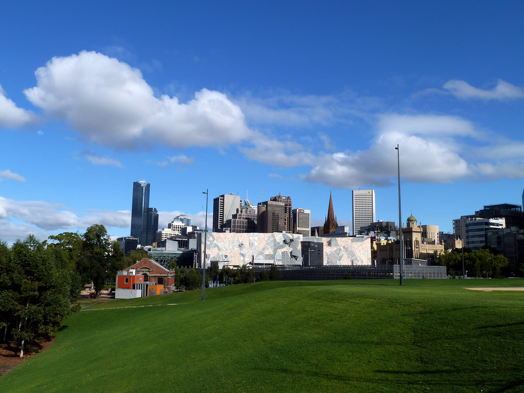
The Upper Terrace is on the northern side at the same level as Flinders Street, about 10 metres above the river bank. Various Melbourne landmarks such as Victorian Arts Centre’s spires, St Paul’s Cathedral and Rialto Tower stand out among the city skyscrapers when viewed from the Upper Terrace.
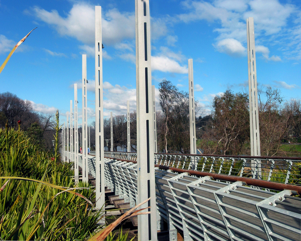
The terraces were constructed using excavated wastes and basalt boulders from the building of nearby Federation Square, Vodafone Area and rail lines. A long ramping footbridge, designed by architects Swaney Draper, links the 3 terraces and provides disabled access. It leads past the Federation Bells to the William Barak Bridge.
The 3 terraces are designed so that each can be individually fenced for gated events, leaving the other areas open to the public.
The shaping of the terraces together with the lining of the drainage channels between them with River Red Gums evoke the billabongs once found on the site. The linear paths and bridge structures also suggest the railways that dominated the site through much of Melbourne’s history. The park’s open spaces are largely shielded from nearby traffic, and the park is remarkably quiet and peaceful given its proximity to major roads and railways.
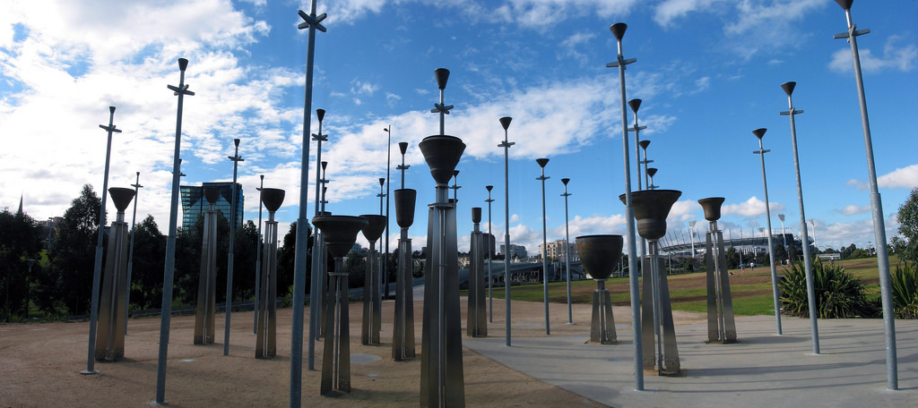
Located in the Middle Terrace, this is a collection of 39 inverted temple-style bells, ranging in size from a small handbell to a 3.5 tonnes bell, mounted on steel poles 2 to 6 metres high. The size of each bell determines its pitch, and collectively the pitch ranges over 4 octaves. The bells are spread through an open space, allowing people to walk between them. By walking among the bells or listening to them from up to 100 metres away, visitors have different aural experiences of the music.
The Federation Bells were commissioned by the Victorian government in 1998 to celebrate Australia’s Centenary of Federation in 2001. They were designed by Neil McLachlan, Ronald Jones and Anton Hasell in collaboration with Swaney Draper Architects.
The bells are struck by computer-controlled hammers programmed to play 7 different 5-minute compositions written by 7 local composers. This sound sculpture plays three times daily at 8-9 am, 12:30-1:30 pm and 5-6 pm. Here is the performance calendar for the past compositions (up to 22/01/2011). In 2008, the City of Melbourne launched a cool and innovative website that allows you to hear each bell virtually and compose music using an intuitive drag-and-drop timeline. You can also submit your own tune for consideration.
Eminent scientist and Australian of the Year (2000) Sir Gustav Nossal launched the Federation Bells installation on 26 Jan 2002. In 2005, the poles were structurally upgraded to ensure their longevity. In 2010, the BBC and Lonely Planet have nominated Federation Bells as one of the world’s top 10 public art (Ref 2).
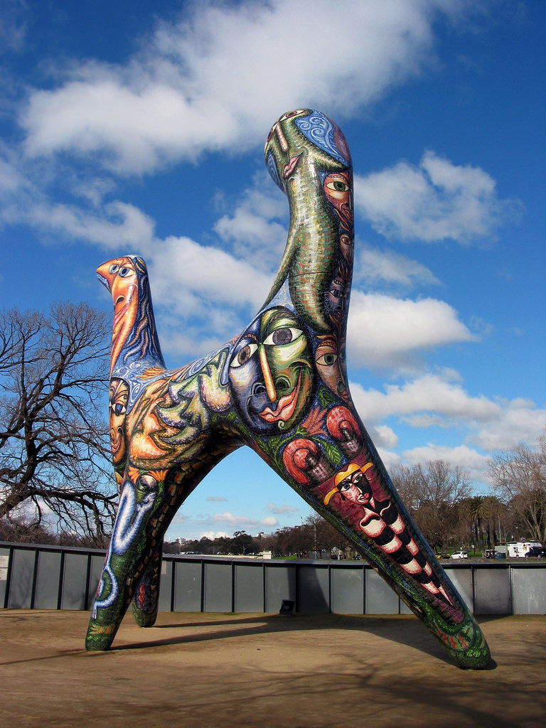
This sculpture of a 10 metres tall, multi-headed, three-legged llama-like creature was the work of ceramics artist Deborah Halpern who set out to make a sculpture that was “wild, whimsical and colourful”. More than 4000 individually cut and hand-painted tiles were fixed to its concrete and steel armature. It was originally installed in the moat in front of the National Gallery of Victoria (NGV) in 1988 but was relocated to her present location in 2005.
This bridge is named after William Barak, a Wurundjeri diplomat, negotiator and artist who was a powerful leader and advocate for his people. As a child, William Barak witnessed the signing of a treaty between the indigenous leaders and Melbourne’s founder John Batman.
It was officially opened in December 2005 for the Commonwealth Games in March 2006. It links the CBD to the sports precinct, offering expansive views of the city. Up to 9m wide and 525m long, the bridge also gives lift access to the ground level precinct and the Number 70 tram.
The Speakers Corner, formerly known as Yarra Bank, was located in the south-eastern corner of Birrarung Marr. It played a significant role in Victoria’s social and political history between 1890 and 1960s. This was used as a location for public lectures, protests and demonstrations – one of the few public spaces in Melbourne where large public assemblies and speeches were allowed without a prior permit. In 1916, demonstrations against conscription drew crowds of up to 50,000 people. In 2000, the National Speakers Association of Australia erected a commemorative plaque, comprising 4 low-lying, stepped pink-granite outcrops inscribed with quotations by artist Evangelos Sakaris, to honour all those who, throughout history, have informed the public on matters of interest and concern.
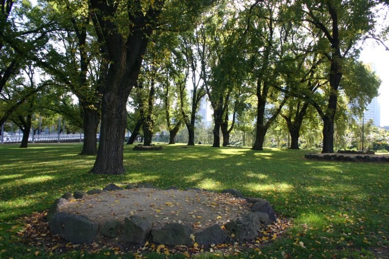
Photo uploaded to Wikipedia by Tirin
The site was most attended during periods of upheaval and struggle, such as during World War I, the Depression and the 1940s. The orators used to stand on 9 bluestone-faced granite mounds to address the crowds. Colourful characters like Chummy Flemming had their own mounds and he eventually had his ashes scattered there. You can still see the remaining mounds, of which 3 had been moved and reconstructed among the mature, heritage-listed elm trees at the western side of the site.
Barbecue facilities and public toilets can be found near the Speakers’ Corner.
This is a children’s art centre and gallery converted from a red brick railway building remaining from the Jolimont railyards. ArtPlay opened in 2004 and runs a range of artists-guided creative art workshops for children, which often extend into an adjacent children’s playground featuring tube slides, sand pits, swinging hammocks, activity panels, rock and rope climbing features and balance beams. ArtPlay is open to the public on weekends and during school holidays and works with schools during weekdays.
This installation, meaning “River Camp”, is an environmental art project made up of several interrelated elements that celebrate the physical and spiritual connections between indigenous people and place. This was created by indigenous artists Vicki Couzens, Lee Darroch and Treahna Hamm. The philosophy underlying the work is gulpa ngawul meaning “deep listening’. It celebrates the diversity of Victoria’s indigenous culture, particularly those of the Wurundjeri and Boonwerrung, through public artworks’ interpretation of local stories.
The central component of the work, the mound campsite or puulwuurn, is a contemporary recreation of a sitting place – an element central to Aboriginal cultural life. A winding, textured pathway recognizes the significance of the eel as a traditional food source for groups camped by the river. A performance space is enclosed by large rocks incised with animal drawings and closer to the river, a semi-circle of metal shields represents each of the 5 groups of the Kulin Nation.
On the outside southern wall of the ArtPlay building are silver touch panels, resembling possum skin cloaks, featuring audio recordings of indigenous people telling their personal stories.
Eel Trap
This sculpture by Fiona Clarke and Ken McKean is based on the design of a traditional indigenous eel trap. The steel sculpture is painted red and engraved with indigenous designs. A local food source, eels were once trapped close to this site, near the shallow waterfalls that used to exist downstream, separating the freshwater of the river from the salty water of the bay. Eel Trap was commissioned by the City of Melbourne in 2003.
Former premier Jeff Kennett whose government was influential in the design of Birrarung Marr described the Ferris wheel as an eyesore, likened it to a ”piddly Meccano set” and believed it should be shifted elsewhere so as not to tarnish the park (Ref 3).
Plant
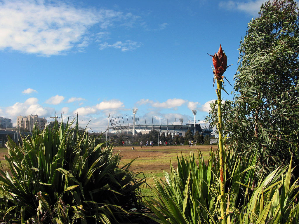
In addition to the mature elms along the river bank and at Speakers Corner, about 200 new trees were planted in the park during its construction. Unlike the water-thirsty European style gardens south of the river, Birrarung Marr was planted with hardy natives that require little watering. Cyclads (Macrozamia communis), Gymea Lilies (Doryanthes excelsa) and Pineapple Zamia (Lepidozamia peroffskyana) were planted on the embankment overlooking Speakers Corner.
The park ecological sensibilities are reflected by the design of the gullies to catch and filter the water from the large runoffs and to return them to the aquifer. The soak and the gravel area perform a similar function.
Reference
- Wikipedia article on Birrarung Marr
- White Hat Guide to Birrarung Marr
- Only Melbourne article on Birrarung Marr
- That’s Melbourne article on Birrarung Marr
- The Age article “Vision for Birrarung marred” published on 1 Apr 2011
- The Age article “Kennett sees blue over eyesore by the Yarra” published on 12 Apr 2010


Very well written and researched. This was a great read. Well done