If you join a day tour to the Great Ocean Road, the coach will normally travel via M1/A1 (Princes Freeway/Highway) in the forward journey and along the coast on the return journey or vice-versa. Two or three stops will be made along the coast, with the coach passing through coastal holiday towns such as Apollo Bay and Lorne. There will only be time to make two or three stops at Port Campbell National Park, that is, at Twelve Apostles, Loch Ard Gorge and perhaps London Bridge.
I would say the gems of these natural wonders are concentrated in Port Campbell National Park. When my two overseas cousins were here about a month ago, I decided to show them the best. Due to limited time, I saved on journey time by sacrificing the coastal drive by driving directly to Port Campbell National Park via M1/A1. In this manner, I would find it less strenuous to drive on the winding coastal road, which would allow more ample time to explore the National Park in greater details.
It takes about 3 hours to drive from Altona to Port Campbell National Park. Add another 25 minutes if you are coming from Melbourne CBD. I had driven this route before in 2007 but had already forgotten the locations of the carparks for the various attractions. I decided to buy a GPS this time but discovered that I could not locate these attractions (such as Twelve Apostles, Loch Ard Gorge, The Grotto, London Bridge) via my GPS. These carparks do not even have an address assigned to them so it is not possible to input a specific address into the GPS. However, the GPS does allow you to enter the GPS coordinates for any location.
Now for the convenience of readers, I will share the GPS coordinates for the various carparks. I do spend quite a lot of time determining these GPS coordinates on Google Maps.
| Carpark to: | Carpark GPS Coordinates |
| Gibson’s Steps | 38.668368 S , 143.112196 E |
| Twelve Apostles | 38.661532 S , 143.105249 E |
| Loch Ard Gorge, Island Archway, Razorback | 38.646304 S, 143.07148 E |
| Mutton Bird Island | 38.647074 S, 143.066939 E |
| Blowhole, Thunder Cave, Sherbrooke River | 38.645696 S, 143.065831 E |
| Port Campbell Town Lookout | 38.617136 S, 142.992113 E |
| The Arch | 38.622918 S, 142.943866 E |
| London Arch (London Bridge) | 38.622228 S ,142.932544 E |
| The Grotto | 38.616228 S, 142.915986 E |
I have plotted on Google Maps these carparks as well as the best vantage points for photo shots (I label these locations as “lookouts”). This map is too large to embed in this blog so I am asking you to click this link to view it. The places of attractions are listed on the left panel according to the order you car would reach them if driving from Melbourne City. Click from this list, any placemark/icon to view the photo taken at a specific location. You will have to zoom into the map in order to separate out the placemarks. Share with your friends if you find this information useful.
I will now describe the various geological features, with selected photos. If you wish to view a larger photo collection, visit my flickr site at:
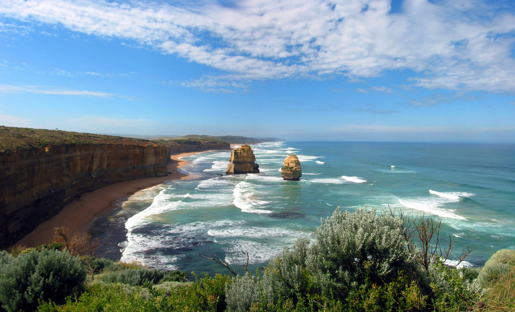
Port Campbell National Park taken on 27 Dec 2007
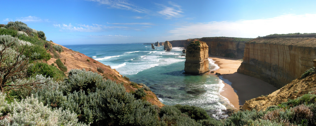
Port Campbell National Park taken on 15 Mar 2011
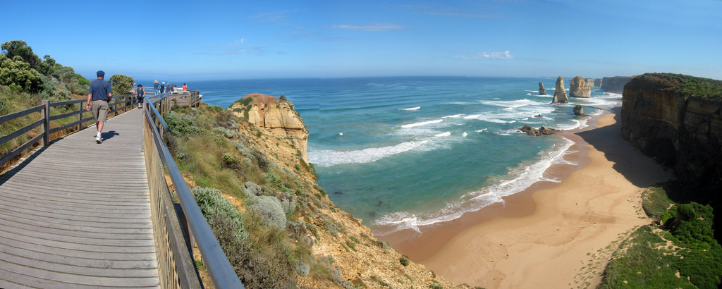
Gibson’s Steps
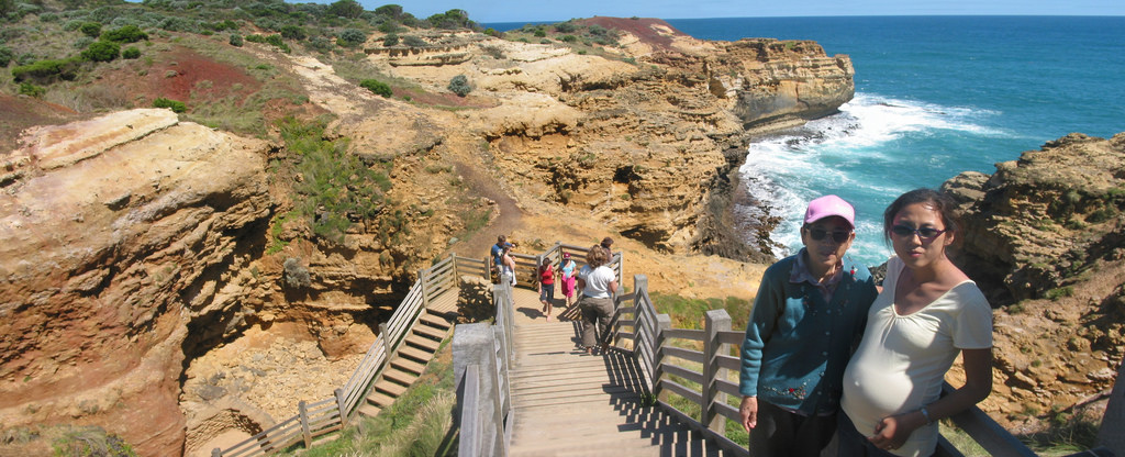
This is the first sightseeing stop for travellers coming from the east. Skip this stop if you do not have the time for I do not feel that it looks very spectacular. There is a flight of 86 steps down to the beach from the 70-metre high vertical cliff. Local settler Hugh Gibson carved these steps into the cliff on existing access used by the original Kirrae Whurrong inhabitants.
Two offshore stacks, named Gog and Magog, may be viewed from both the viewing platform and the beach. These stacks are not part of the 12 Apostles. I have included a photo of these stacks in the Google Maps.
Twelve Apostles
This is a collection of miocene limestone rock stacks rising majestically from the Southern Ocean between Princetown and Peterborough. The site was previously known as the Sow and Piglets, with the Sow referring to Mutton Bird Island and the Piglets the smaller rock stacks to the east. In 1922, it was renamed to the Twelve Apostles for tourism purposes, despite only ever having 9 stacks.
26 million years ago, the whole place was under the sea. When the marine animals died, their calcium-rich skeletons became deposited on the soft clay floor and built up to 260 m of limestone rocks, which became exposed when the sea level dropped during the last Ice Age.
The apostles were formed by constant erosion of the limestone cliffs that began 10–20 million years ago. The blasting winds of the Southern Ocean, known as the “Roaring Forties”, gradually eroded the soft limestone to form caves in the cliffs, which then became arches. When these arches collapsed, they left rock stacks of up to 45 metres high, isolated from the shore.
In certain areas, the coastline has retreated uniformly, leaving no clues to its original shape but in other places, the weaker sections gave way first, thus creating the stacks and arches of today.
The stacks are still undergoing continuous erosion. On 3 July 2005, a 50 metres tall stack collapsed, leaving eight remaining. The rate of erosion at the base of the limestone pillars is approximately 2 cm per year. Due to wave action eroding the cliff face, existing headlands are expected to become new limestone stacks in the future.
The sights at the Twelves Apostles are reputably most spectacular during sunrise and sunset, with opportunity to view the little penguins, about 15 – 20 minutes after sunset.
There is a Visitor Information Centre, which apart from the coastal towns of Port Campbell, Princetown and Peterborough, is the only place where you can find toilet facilities as well as something to drink and eat.
Loch Ard Gorge
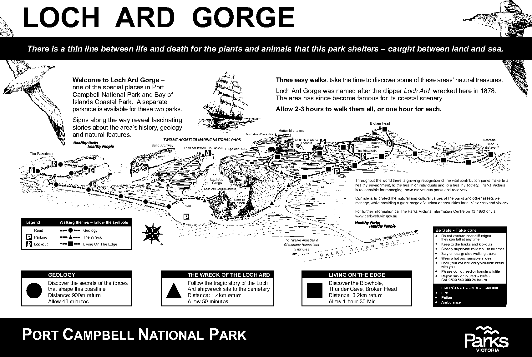
Thanks to Parks Victoria for the use of this map, where the original pdf can be downloaded here
The gorge is named after the 1693-tonne clipper ship Loch Ard, which crashed against the reef of nearby Mutton Bird Island on 1 June 1878 approaching the end of a 3-month journey from England to Melbourne. The Loch Ard sank within 15 minutes. Ironically, the passengers and crew had held a party the night before to celebrate the end of their journey.
Of the 54 passengers and crew, only 2 survived: Tom Pearce, a ship’s apprentice, and Eva Carmichael, an Irish woman immigrating with her family. Both were 18 years old. Tom clung to a lifeboat and was swept into the Loch Ard Gorge. Eva, who could not swim, used a chicken coop and then a spar to keep afloat. After hearing her cries for help, Tom struggled for an hour to bring her to the beach. He sheltered her in a cave at the end of the gorge and revived her with some brandy, which had washed ashore.
After both had slept overnight in the cave, Tom climbed out of the gorge to search for help. He came upon two stockmen from nearby Glenample Homestead. The owner, Hugh Gibson, made arrangements to rescue Eva from the gorge. Eva and Tom never saw each other after they recuperated at Glenample. Eva returned to Ireland and later married. Tom eventually became a ship’s captain. I wonder why nobody has thought of making a movie out of this story. Add in some elements of romance and this may turn out to be a blockbuster, like Titanic.
A feature viewable from Loch Ard Gorge Wreck Lookout (400m return from the carpark) called the Elephant Rock is often mistaken with that of either Island Archway or London Bridge. It is so named presumably because its anterior end resembles an elephant trunk.
If you plan to walk on the sandy beach at the bottom of the gorge and do not wish to bring sand into your car, bring a pair of slippers. Be careful with the stair as it is quite steep.
Tom and Eva (formerly Island Archway)
The arch of the nearby Island Archway collapsed in June 2009. The feature now appears as two unconnected rock pillars. They have since been officially named Tom and Eva after the two teenage survivors of the Loch Ard shipwreck.
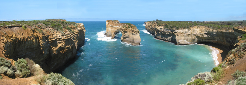
Island Archway
|
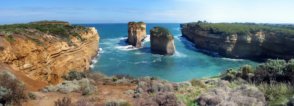
Tom and Eva
|
Razorback
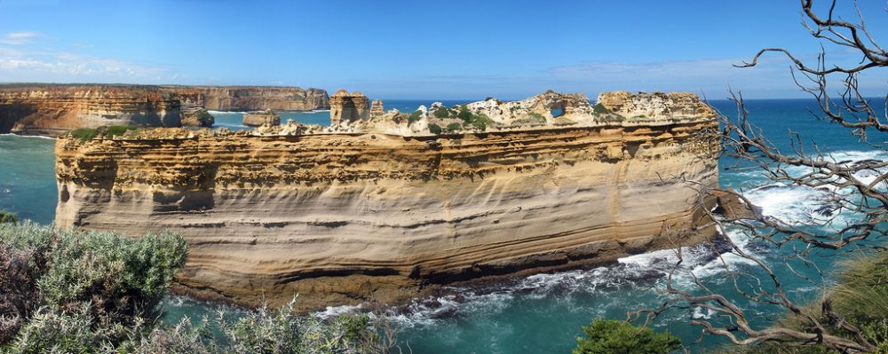
To the east of Loch Ard Gorge on the same walking path to Island Archway, you will eventually arrive at a very imposing structure called the Razorback, which I feel is one of the most impressive sights in Port Campbell National Park. This walk called the Geology Walk is a 900-metre, 40-min return loop from the carpark, encompassing the Island Archway and Razorback.
My mother thinks that the Razorback looks like a slice of multi-layered cake. The structure in the centre of the photo above (to the left and behind Razorback), with two pointed heads that look like the fairy chimneys of Turkey’s Cappadocia is known as the Pudding Rock. You can view the location and a closeup of the Pudding Rock in my Google Maps.
Mutton Bird Island
This island was previously known as “The Sow” while the Twelve Apostles were known as “The Piglets”. This is a large and unusual island, which juts out from the coast to the west of Loch Ard Gorge.
It is only 60 metres from the mainland and becomes home to some 200,000 short-tailed shearwaters between October and April. Each year these birds travel some 30,000 km, spending summer in the northern Pacific Ocean and returning to the Bass Strait in late September to nest. During the nesting period, they fly out to sea to feed, returning to the rookery each evening. They can be seen from October to April but January and February are the best times to view them.
It is a 100-metre walk on crushed rock from the carpark to the viewing platform.
Living on the Edge Trail
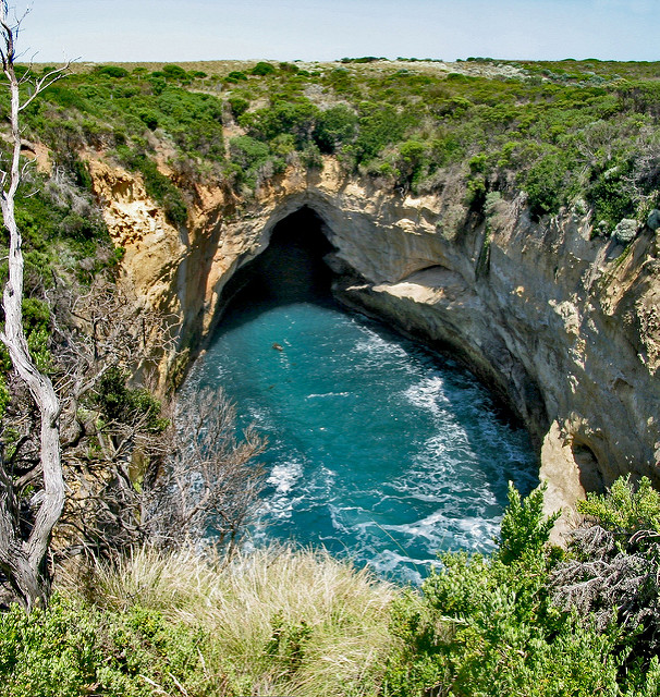 This long 3.2 km return trail, encompassing the Blowhole, Thunder Cave, Broken Heads and Sherbrooke River, will take an hour and a half so give this trail a miss if you do not have the time.
The Blowhole is the nearest attraction from the carpark, probably about 400 or 500 metres away. The Blowhole demonstrates how the sea waves attack weaker parts of the rocks, carving a 400-metres water tunnel underground. In areas where the roof has caved in, tourists can peer down a “blowhole” at the water churning below.
The Thunder Cave, 1.1 km walk from the carpark, is about 25 metres deep and is full of crayfish sitting on ledges. There are steps descending down the gorge into a platform where you can view the Thunder Cave’s entrance (left side of photo below) and the narrow passage of water into the sea.
The Sherbrooke River is a small river that feeds into the sea near the battered low-slung headland of Broken Heads and the steep-pitched Sherbrooke Beach. The estuary view is dominated by the offshore Baker’s Oven formation and the craggy Broken Head. You would be able to come within close distance to experience the fiery and might of the stormy ocean.
Port Campbell Town Lookout
If you wish to explore Port Campbell National Park in greater depths or in a more leisurely manner, Port Campbell Town will be a convenient base, though its accommodation may be dearer due to its proximity to the various attractions.
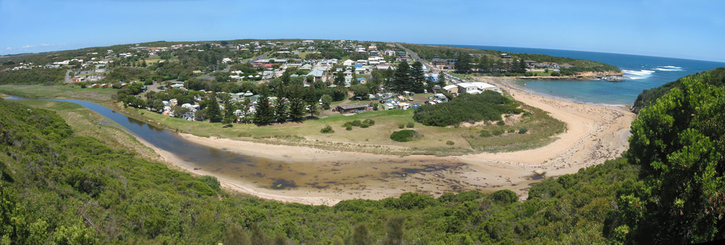
The Discovery Walk and Town Lookout, which offer spectacular views of the town, bay and coast, can be accessed via a car park on the Great Ocean Road to the west of the town. Alternatively, from the beach at Port Campbell Bay, climb the steps to reach the cliff top via a walking track. You would not have enough time for this trail if you are on a day trip from Melbourne. You should reserve your time for three more spectacular scenic spots west of Port Campbell.
The Arch
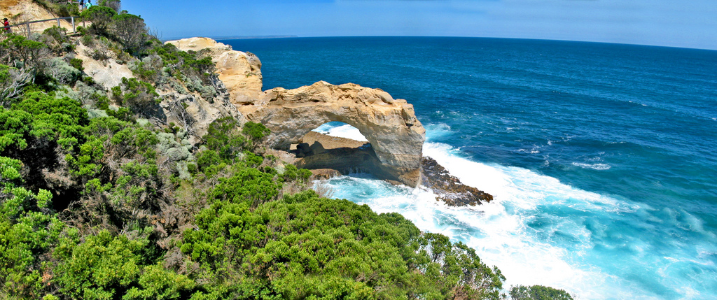
The Arch is located just before London Bridge, heading west from Port Campbell towards Peterborough. It is best seen during rough seas when the waves crash in and around the Arch.
London Arch (formerly London Bridge)
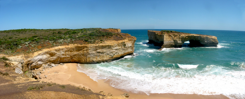
London Arch is a natural arch formed through erosion. It was previously called London Bridge, due to close resemblance of its double arches to the actual bridge in England. On 15 January 1990, the arch closest to the shoreline collapsed unexpectedly, leaving two tourists stranded on the outer part until they were rescued uninjured by a helicopter. The name was subsequently changed to London Arch.
The Grotto
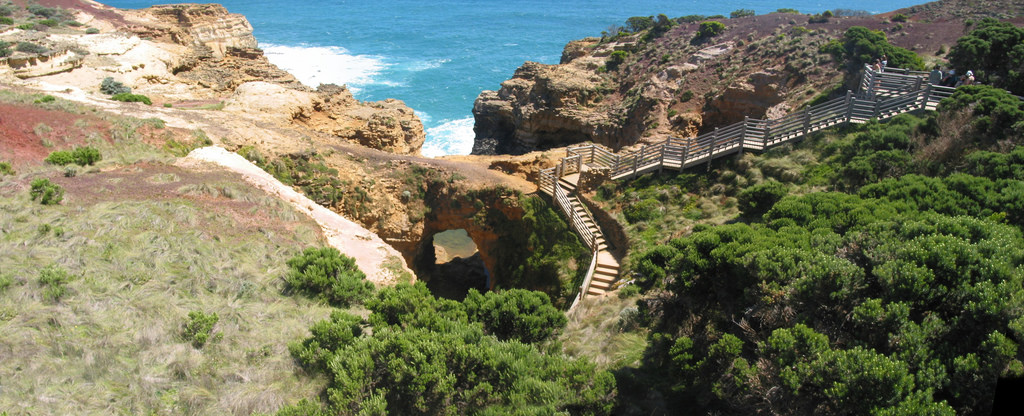
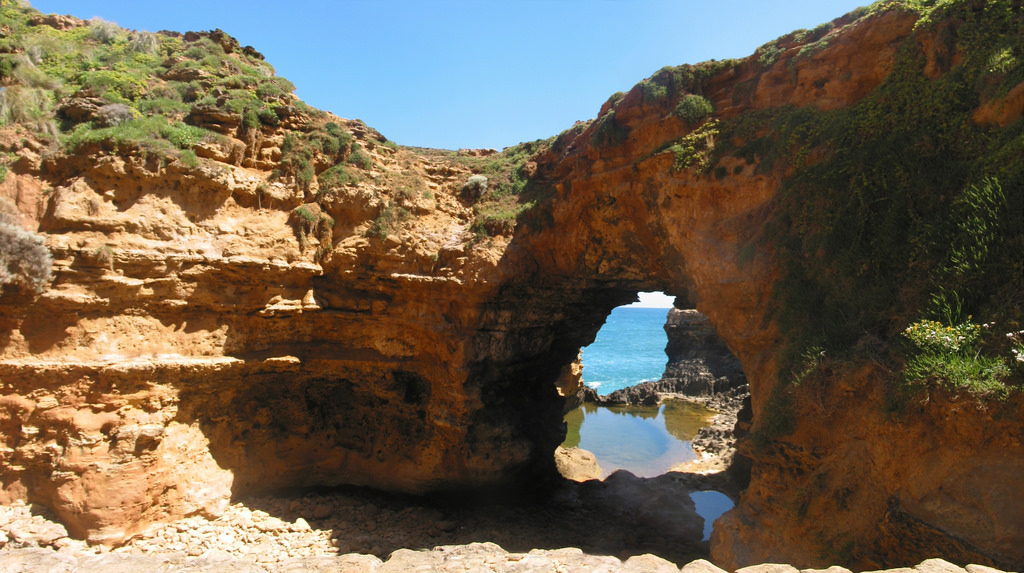
The Grotto is a sinkhole geological formation. I would say this is the “hidden gem” of the Great Ocean Road, for it is relatively less well-known compared to other attractions and many people are not even aware of its existence.
The first of the viewing platforms at the Grotto is easily accessible by a crushed rock path and wooden boardwalk 400m from the car park, and the other viewing areas are also generally accessible. The rock formations below are accessed via many stairs.
The still, clear water of the Grotto is often in stark contrast to the stormy waters of the Southern ocean beyond.
The Grotto reminds me of the Blue Grotto and the Azure Window in Malta.
I will update this post if I discover more places of attractions in this area in the future. Before you embark on your journey, please check Parks Victoria’s website for any closure of a particular place due to damage or any other reason.
References
- Parks Victoria page on Port Campbell National Park
- Visit 12 Apostles Website – Coastal Trails and Lookouts
- visitvictoria.com – Coastal Attractions on Great Ocean Road
- Wikipedia article on Port Campbell National Park
- webwombat.com – Loch Ard Gorge and Shipwreck Coast
- www.aguidetoasia.com – Port Campbell, Australia
- www.travelvictoria.com.au Information on Port Campbell






Fantastic photography and comprehensive information. Gibson Steps and Bay of Islands are two of my favorite places on this section of coast but I agree that Loch Ard Gorge is the jewel in the crown. Please note that Thunder Cave lower viewing platform and the Blowhole lookouts (at Loch Ard Gorge) are no longer open.
Great information and I wish more visitors took the time to enjoy the area in the way you have (and made more of the opportunity to view the formations in dusk and dawn light.)
Please note that some of your links are out of date. Thanks for sharing your images and insights. Power to Altona!
Thanks Mark, the links are now updated.