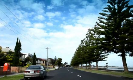
When you are enjoying your time at the Altona Beach or driving along the Esplanade, have you been fascinated by the large body of water before your eyes. I always do. Have you thought of finding out more about Port Phillip Bay which is an integral part of Altona? In fact, Port Phillip Bay has very unique geographical features and a very interesting history. I will cover the geography of Port Phillip bay in this post and its history in a later post.
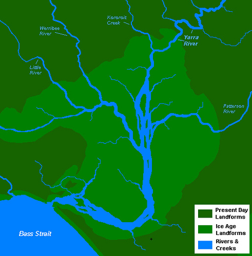
Sea level was about 130 metres lower than it is today in the last glacial period, which ended 18,000 years ago. The Yarra, Werribee, Little and Patterson Rivers, with Kororoit Creek, flowed down what is now the middle of the bay, forming a delta and merging into a larger river, before emptying into Bass Strait. As the ice caps receded 8000 years ago, the sea level rose, flooding the delta and river valleys, forming what is now recognized as Port Phillip Bay.
Map by Nick Carson
Port Phillip Bay is the biggest enclosed “sea” in the Southern Hemisphere, 1,950 km2 in area with 264 km of coastline and up to 58 km from north to south and 41 km from east to west. It is separated from Bass Strait by the Bellarine Peninsula on the southwest and Mornington Peninsula on the southeast.
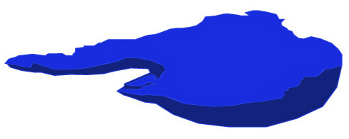
The bay holds 25 km3 of water and is fed by a water catchment area of 9790 km2. The bay is in relatively good condition despite accommodating over 3.2 million people in the catchment area. When viewed in three dimensions, Port Phillip Bay resembles a saucer, having a very large surface area relative to a very shallow depth. The deepest portion is only 24 m and half the bay is shallower than 8 m, with the deepest parts skewed towards the eastern side.
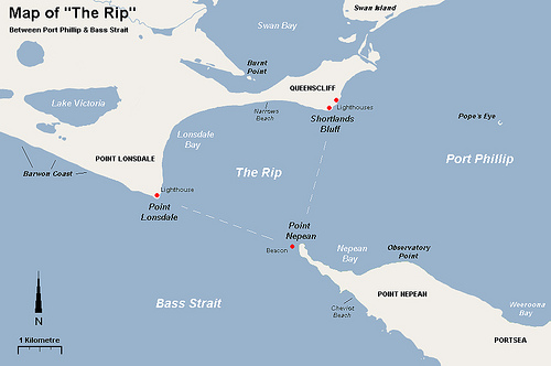
Ships from Bass Strait can enter Port Phillip Bay only through a narrow entrance, the Rip which is a triangular area of water between the land points of Point Lonsdale, Point Nepean and Shortlands Bluff, also known as the Heads. Point Lonsdale and Point Nepean are 3.5 km apart but the projecting reefs reduce the navigable width to about 1 km. Only 4% of the Bass Strait waters mix with those of the bay, typifying its enclosed nature.
Map by Nick Carson
The eastern shore is characterised by sandy beaches extending from St Kilda, down the Mornington Peninsula to Portsea. Longshore drift carries sand from south to north during winter and from north to south during summer. There is a greater variety of beach types on the western side of the bay. Numerous sandbanks and shoals occur in the southern section.
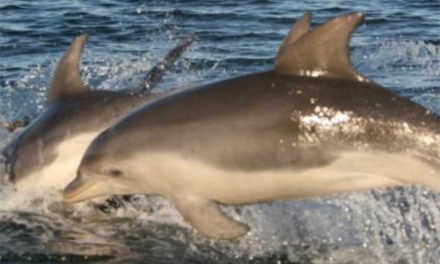
Port Phillip Bay has a great diversity of flora and fauna of over a 1000 species. Swan Bay, adjacent to Queenscliff, is an important feeding ground for waterbirds and migratory waders. The Mud Islands, off Sorrento, are an important breeding habitat for White-faced Storm-Petrel, Silver Gull, Australian Pelican and Pacific Gull. Navigation beacons in this area also host breeding colonies of Australian Fur Seal and Australian Gannets.
The eastern shore has undergone intensive residential developments while the western shore still contains a number of internationally-significant wetland habitats. The Port Phillip Bay (Western Shoreline) and Bellarine Peninsula Ramsar Site , comprising 6 coastal areas covering 229 km2 of land on Bellarine Peninsula and along Port Phillip’s western shore, was designated a wetland of international importance under the Ramsar Convention on 15 December 1982. It contains 3 wintering sites for the critically-endangered Orange-bellied Parrot.
References:

looking forward to exploring the western side of the bay in my little yacht.