Port Fairy is a coastal town on the Moyne River in southwestern Victoria, 290 km west of Melbourne (4 hours drive) and 28 km west of Warrnambool. It is where Dr. Denis Napthine, the 47th Premier of Victoria, lives.
The Knarn Kolak aboriginal people have long inhabited the area. Port Fairy was named in about 1827 when Captain Wishart sheltered from a storm at the mouth of the River Moyne in his cutter Fairy. In the early 19th century, whalers and seal hunters used the coast in this region. John Griffiths established a whaling station on Griffiths Island in 1835 and the first store opened in 1839.
In 1843, a Sydney solicitor James Atkinson purchased 2023 hectares of land in the town, built a harbour on the Moyne River, renamed the town “Belfast” after his hometown in Northern Ireland and encouraged Irish immigrants to settle. Agriculture developed in the region and Belfast became an important transport hub. In the mid-to-late 19th century, Belfast was one of Australia’s largest ports, catering to the whaling industry. In 1887, the State Parliament passed an act to revert the town to its original name Port Fairy. A railway was extended to Port Fairy in 1890 but closed in 1977. It has been converted into the Port Fairy to Warrnambool Rail Trail.
At the 2006 census, Port Fairy had a population of 2,599. Its main industries are tourism and fishing, and it is the home port for one of Victoria’s largest fishing fleets.
Attractions of Port Fairy
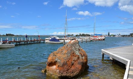
Moyne River and Fishermans Wharf
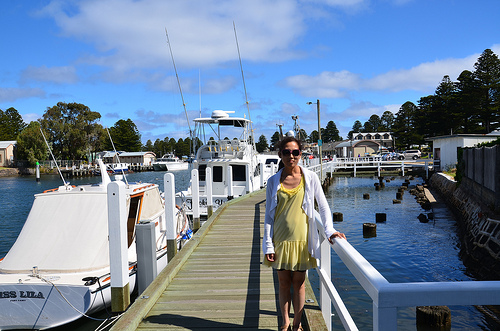
The main focal point of Port Fairy is the Moyne River. The Fishermans Wharf area along the river is lined with boats and fishing craft.
There are good views of river activity from the footbridge over the Moyne or from the fortifications at Battery Hill.
The walk along Fishermans Wharf is delightful and can take you up into the town (if you head north) or towards Griffiths Island if you head south. The wharf is used by both amateur anglers and commercial fishermen who bring their catch in from the Southern Ocean.
Cruises around Port Fairy Bay and to Lady Julia Percy Island also operate from the wharf.
There is a big carpark off Gipps St at King George Square (GPS coordinates S38.388142, E142.240966). Alternatively, you can park your car at the south end of the wharf near the playground and the causeway to Griffiths Island. It takes about 10 minutes to walk the entire length of the wharf.
Notorious at Martin’s Point
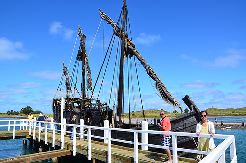
The Notorious is a full-size replica 15th century caravel built by a sailor and cabinet maker, Graeme Wylie, in Bushfield near Warrnambool. Made entirely from reclaimed timber (mostly Monterey Cypress), the ship is 21 m long, 6 m wide, 17 m high, 55 tonnes in weight and covered in 600 litres of tar. Inspired by the southwest’s legendary Mahogany Ship, Graeme took 10 years to research, design and construct the ship, relying on period drawings of caravelles and advice from historians.
According to this legend, two sealers were walking on a beach westwards to Belfast (Port Fairy) in 1836, after capsizing of their boat and drowning of their companion near the Hopkins River mouth. They came across a wreck in the sand dunes – a very ancient ship of unusual appearance and having very hard dark timber like mahogany. Seen by many locals over the next 3 decades, it was last sighted in 1880 after which she was concealed by drifting sands.
The ship was speculated to be of various origins – Spanish, French, Chinese and Portuguese. Later work by renowned historian, Sir Kenneth McIntyre, uncovered evidence that this Mahogany Ship may be one of 3 caravels that was sent on a secret Portuguese expedition from the Spice Islands in 1522, under Cristóvão de Mendonça, to look for Jave la Grande. This is a large landmass between Indonesia and Antarctica indicated on a series of 16th century French world maps, the Dieppe maps. The location of the Mahogany Ship remains a mystery despite a $250,000 State Government reward offered in the early 1990s and many searches by scientific and interested parties.
Griffiths Island
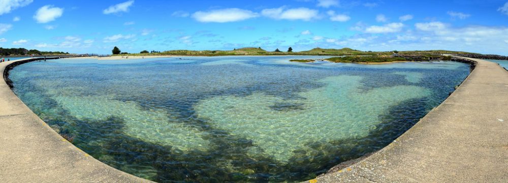
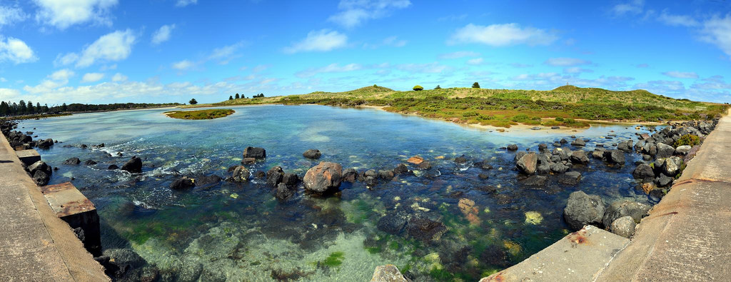
Griffiths Island is a small island at the mouth of the Moyne River and is linked to the mainland via a pedestrian causeway (right side of photo below). A walking track, including some beach-walking, circumnavigates the island.
The causeway forks into 2 circular branches (left and right) which join the island, enclosing a lagoon and a beach (top left quadrant of photo below).
The water in the lagoon is sparkling clear and its motley of colours (darker areas interspersed by lighter areas) may be due to the presence of corals.
As shown in the following video, the lagoon seems to brimming with life with its gently rippling, scintillating water.
Rock formations and coastal vegetation integrate seamlessly with the surrounding lagoon, making a picture-perfect photo.
The island was originally known as ‘mallone’ or ‘mallin’ in the local aboriginal language. It was named after John Griffiths, who established Port Fairy’s whaling industry on the island in 1835. Sealers were also established on the island at about the same time but overhunting soon eradicated the local seal population. Whaling too ceased in 1843. In about 1850, a mission to the island aborigines was established, which only lasted for 3 years.
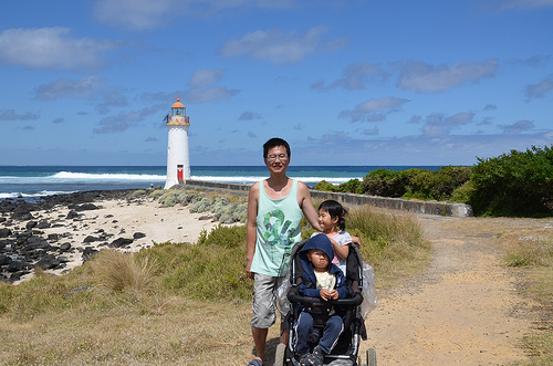
On the eastern end of the island, 400 metres from the causeway, is the 11-metre high Griffiths Island Lighthouse, built in 1859 from bluestone by John Griffiths, employing Scottish stonemasons. It was originally built at the tip of Rabbit Island which has since merged with Griffiths Island through landfill and the construction of a breakwater. The lighthouse was automated around 1956 using a solar-powered light with a wind-assisted generator and is still sending out light to sea today.
Following automation, two bluestone cottages built for the lighthouse keepers were demolished. In 2000, volunteers helped to restore the site by revealing the foundations of the cottages, which had been overgrown. The gardens established by the lighthouse keepers still live on with many hardy plants flowering in the appropriate season.
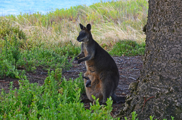
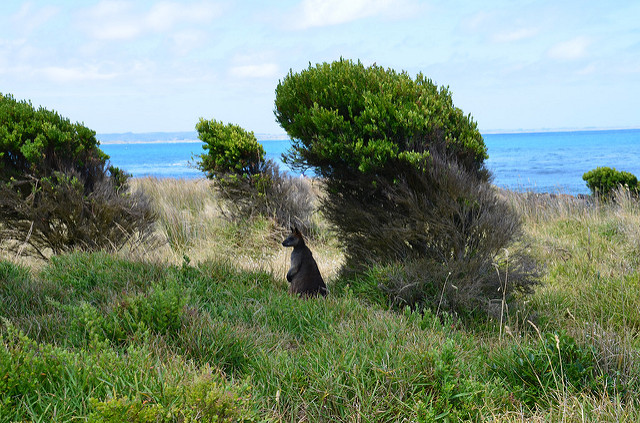
Along the way to the lighthouse, panelling details the island’s indigenous and whaling heritage. You will pass grazing swamp wallabies and underground burrows of shearwaters.
 |
 |
Wallaby carrying a baby in its pouch
Much of the land area of Griffiths Island is covered by the underground burrows of an estimated seasonal breeding population of 30,000 Short-tailed Shearwaters or Australian Muttonbirds. These birds arrive here late September from the Aleutian Islands near Alaska. At dusk, they return in swarms to their nests to incubate their eggs and subsequently feed their chicks, after a day hunting at sea. The young birds leave in early May to the northern hemisphere, after the adults have departed. A viewing platform has been built for visitors to enjoy the spectacle. I did not manage to see or spot the shearwaters but did see many butterflies at this viewing platform.
Battery Hill and FortThe site of the Port Fairy Battery has been used for defence purposes since 1867 when a 32 pdr smooth-bore muzzle-loaded artillery piece was installed. Another was installed in 1872. One was sold to the Borough Council and moved to the Botanic Gardens for use as a monument around 1887. In 1874, further defences were added including a redoubt. The site now contains 6 guns, comprising two 80 pdr rifled muzzle-loading guns mounted on iron carriages and slides, and two 32 pdr and two 68 pdr smooth bore guns mounted on wooden carriages.
Beaches
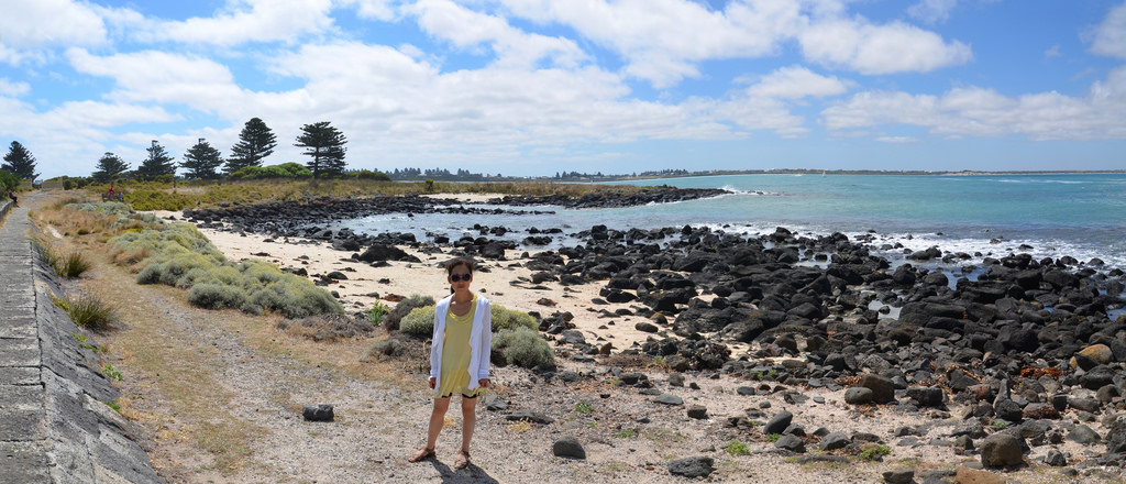
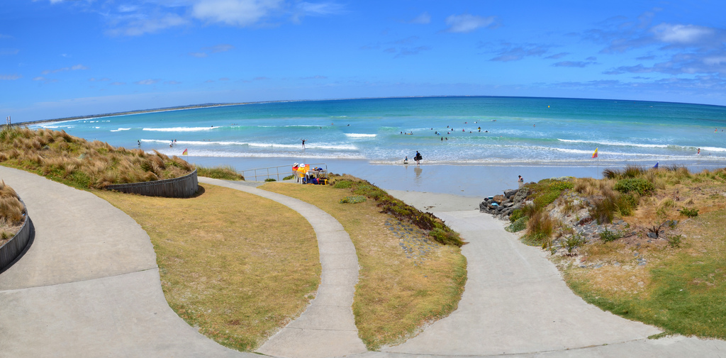
Port Fairy has 3 main beach areas. East Beach is a patrolled surf beach facing Port Fairy Bay and can be accessed via Beach St.
Along Ocean Drive and facing the Southern Ocean is South Beach and Peas Soup, a lagoon popular with families. Secluded beaches can be found on Griffiths Island.
Historic and Art Walks
Much of Port Fairy’s appeal lies in its well-preserved 19th-century buildings, of which 50 are protected under the National Trust of Australia. Many of the oldest buildings are located around King George’s Square and include the Merrijig Inn (1844), the Customs House (1860) and the Moyne Steam Flour Mill (1860). The 1859 Courthouse at 30 Gipps Street, hosts the History Museum with displays dedicated to the settlement’s development and shipwreck history.
The town has 2 historic walks, an art walk and a maritime and shipwreck trail, with maps available from the Information Centre on 4 Bank Street. Port Fairy has emerged as an artists’ colony over the past 20 years.
The Art Walk takes in 11 galleries and studios, which include:
- Whalebone Gallery (39A Bank Street, open 10-5 most days, Sun 10-4) – a co-operative showcasing the work of 7 local artists. It features metal and ceramic sculptures, blown glass, silver jewellery and some intriguing pieces incorporating stained glass, fabrics and layered collage by artist Jill Edwards.
- Wishart Gallery (19 Sackville St) – a large contemporary art gallery exhibiting works by local and leading Australian artists.
- Glass blowing at Eclectic Designs Studio (62 Regent Street, open 1-5pm daily except Wed).
- Little Doll House Museum (34 James Street, Thurs-Mon 10.30am-4pm)
- Preston Studio/Gallery (41 Regent Street, open 7 days), displaying the works of realist painter Wilma Preston.
Festivals
- Port Fairy Folk Festival – this most famous annual event is held during the Labour Day long weekend in March each year since 1977.
- Moyneyana Festival – the other major town celebration is held over summer from Christmas eve to 26th January.
- Port Fairy Spring Music Festival – held over a weekend every October since 1990.
- Port Fairy Show – held on the Port Fairy Showgrounds on the 1st Saturday of November each year, since 1854.
- Tarerer Festival – held at Killarney, just east of Port Fairy, this event celebrates Koori culture with music, song, dance, visual arts and displays.
Markets
Port Fairy hold both regular markets and markets to coincide with its many annual festivals. The Farmers Market is held monthly on the 3rd Saturday. The Craft Markets are held on the 2nd and 4th Saturday of each month as well as on the 1st Saturday from June to September to coincide with the Winter Weekends. The markets are always held on the Village Green, at the corner of Bank and Sackville Streets, except for the New Years Day and January markets which are held at King George Square down at the wharf.
Other Attractions
- Whale viewing, particularly of the huge Southern Right Whales, in winter between June and October.
- Boat tours from the Wharf to around Lady Julia Percy Island, 22 km southwest of Port Fairy. It is Australia’s only off-shore volcano formed 7 million years ago by violent underwater eruptions that finally separate Australia from Antarctica. It is one of 4 Australian fur seal breeding colonies in Victoria and possibly the largest colony in Australia.
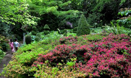
- The Botanic Gardens first established in 1858 and the expansive Southcombe Park which fronts a significant area of the town’s southern coastline.
- Kite flying – the Kite House at 27 Cox Street offers free kites during school holidays. It also rents bikes ($22 for 24 hours).
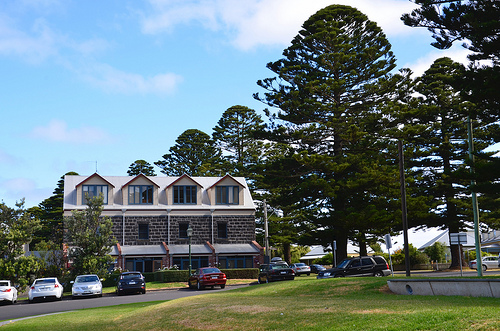
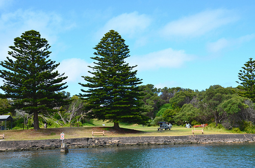
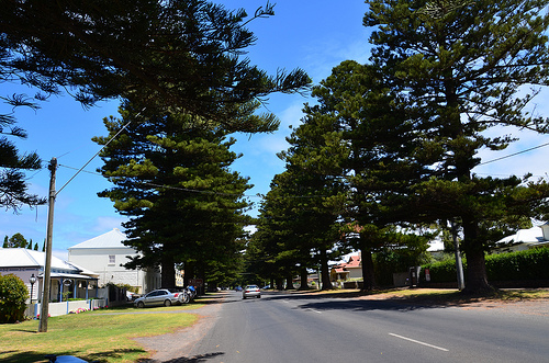
- The iconic avenues of Norfolk Island Pine Trees that line the streets of Port Fairy have been protected in the Victorian Heritage Register. The 269 trees, which were planted in the nature strips of the roads bounded by Gipps Street to Victoria Street, Campbell Street, Albert Street and Regent Street define the original 1843 town plan of Belfast, now known as Port Fairy.


