I first heard of Cape Bridgewater from a Malaysian Chinese whom I met at Colac Botanic Garden last April. He was astonished by the beauty of the place, describing it as having a Martian landscape unlike any place on Earth. I was sold and decided that I must visit the place one day. Never did I expect this day to come so quickly. I was trying to book holiday accommodation for the Christmas to New Year period in Lakes Entrance, Mount Gambier, Warrnambool and Lake Hume, to no avail. Then I found a holiday house in Cape Bridgewater so I decided to give the owner a call. It happened that someone who had booked the place for a long stretch would like to shorten it due to visiting friends from overseas. I was hence fortunate to book this place for 4 nights from 27th to 31st December 2011.Cape Bridgewater is located on the western shore of Bridgewater Bay, 21 km southwest of Portland and 383 km (about 5 hours drive) from Melbourne. It lies within the Discovery Bay Coastal Park. The bay and cape was named after the Duke of Bridgewater (1756-1829) by the British navigator Lieutenant James Grant on 4 Dec 1880, who was sailing along the Victorian coastline in the Lady Nelson. The area was settled in the 1860s, known as Bridgewater Lower for some years, with a Post Office opened in 1863 and closed in 1968.
Petrified Forest and Blowholes
Cape Bridgewater and the Bridgewater Bay are the remnants of a partially submerged volcanic caldera. Cape Bridgewater is once a volcanic island that is now joined to the mainland by calcified sand dunes. There is a large blowhole and what appears to be a Petrified Forest but are not actually fossils. These columnar and branching calcrete structures of over 1 metre high called rhizo-concretions are hollow tubes of limestone, eroded as a result of millions of years of rainfall. To the west is a large area with huge sand dunes. For these reasons, the Cape and the nearby coastal area is classified by the government as the second most important coastline in Victoria, after the “Twelve Apostles” along the Great Ocean Road.
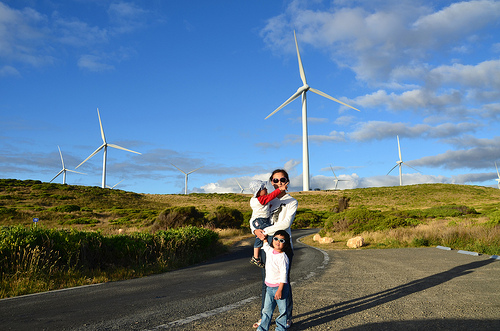
To visit the Petrified Forest and Blowholes, drive for about 2.3 km from Bridgewater Rd to the carpark (GPS coordinates S38.379551, E141.369018) at the end of Blowholes Rd. You will pass by many wind turbines. I cannot help gasping at the proximity of these gigantic turbines towering high above undulating coastal landscapes. This wind farm is one of the 4 sites of the Portland Wind Farm which is developed by the company Pacific Hydro. Being one of Australia’s largest wind farms, the Portland Wind Farm produces enough electricity to power a city the size of Geelong. Cape Bridgewater Wind Farm, comprising twenty-nine 2MW generators, was the largest wind farm in Victoria when completed in 2008.
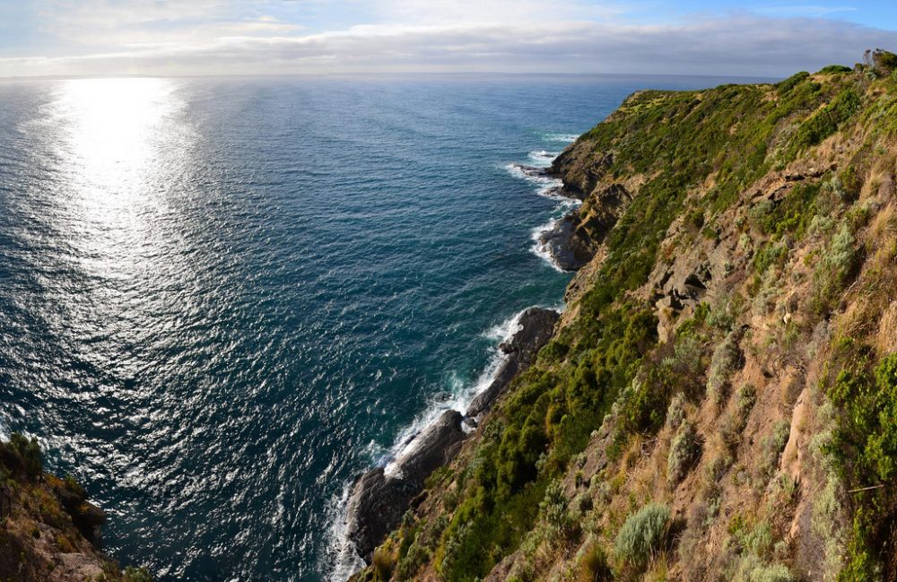
A short walk from the car park are a series of blowholes – tunnels that have been etched out of the soft layers of purple volcanic scoria rock at the base of the black basalt cliff by the waves. During rough seas, large waves crash into the tunnels and shoot a spray of water high into the air, creating a spectacular sight and a sensational cannon-like noise. You can see this wave action in the initial part of the above video (the blowhole happens to be the video thumbnail). Old aboriginal middens can also be seen along the cliff tops.
Freshwater springs flow from the cliffs on the west coast of Cape Bridgewater forming freshwater rock pools. From the Blowholes, red markers lead north for 2 km past spectacular lookout points to a green marker which denotes the spot of the “watering place”. It was getting dark so we had to go home and did not manage to see the springs. If you walk south-east from the Blowholes, you will reach the highlight of the area – the barren moonscape of the Petrified Forest. Many websites still inaccurately reproduce an early theory that the Petrified Forest was formed by the smothering of a forest of Moonah trees by a large sand dune. Water seeping down through the sand formed a sandstone crust around the decaying tree trunks, which were left with a hollow centre. This outdated publishing may be a deliberate tourism marketing tactic though since the truth is usually not as exciting.
Seal Walk
Continuing the southeast walk along the coastline will bring you to Seal Point, the southernmost tip of the peninsula where a viewing platform overlooks a colony of up to 650 fur seals. This route is about 3 hours return from the Blowholes carpark. December is the peak breading time but the seals can be seen all year round. A 45-minute boat trip with Seals by Sea Tours will take you on alongside the rock platforms and into the mouth of the Watery Cave where you will experience a unique interaction with the seals, in their natural habitat.
Probably I am too early for I cannot see a single seal on the rock platforms shown in the above photo. Someone has posted a video of the seals on Youtube so I know this is indeed their hangout location.
Alternatively, you can take a shorter route to Seal Point (2.5 km 1 way, 2 hours return) from the carpark at the hill atop the Bridgewater Beach (GPS S38.370669, E141.404951). This is supposed to be a more strenuous route but I find the wide paths and gradual ascent/descent quite easy even for people who do not do much hiking. You can do the return trip for less than 2 hours. This walk is however not suitable for prams and wheelchairs due to the slopes so I did this walk alone without my kids.
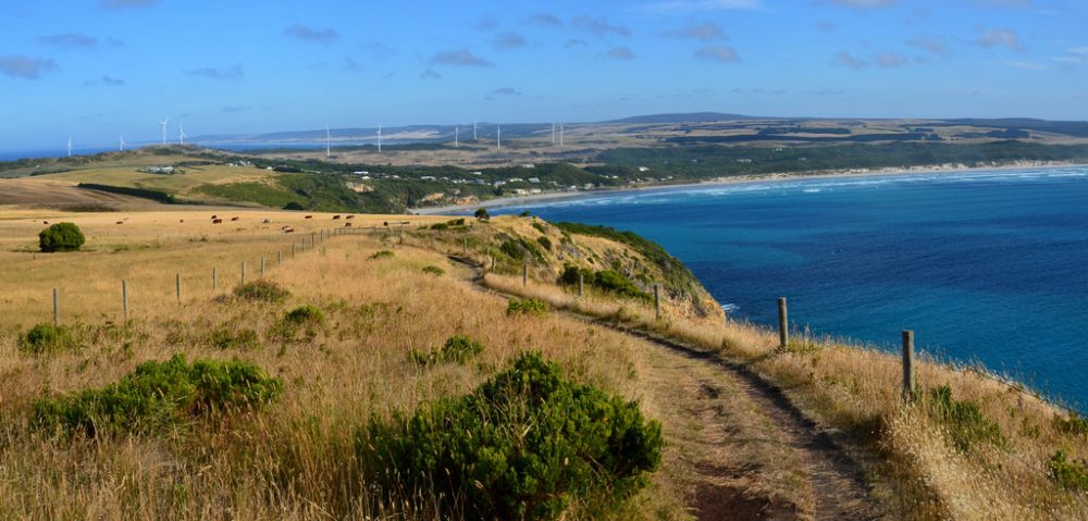
As seen in the above video, the walk takes in sweeping vistas of Bridgewater Bay and moving circles of waves towards Bridgewater Beach. The trail also passes by Stony Hill – the highest coastal cliff in Victoria, 130 metres above sea level. There is a sign that tells you that you are at the highest coastal elevation in Victoria.
Somewhere between the carpark and Stony Hill, you can walk down to a jetty where you can see a rusty shed. This area used to be a hive of activity around the turn of the 19th century. The Portland fishing fleet used to anchor in the bay, sheltered from prevailing westerly winds. Boats were lifted out of the water by a gantry and stored in sheds or in a cave between the jetty and Seal Point.
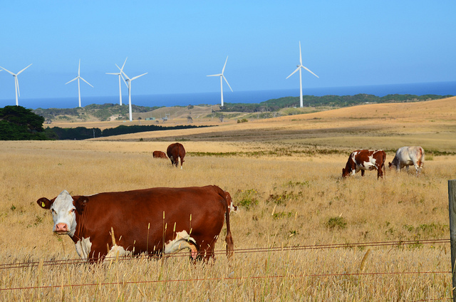
On the hill behind was McKinley’s Guest House, a popular holiday retreat for visiting artists. Now this is a heritage-listed site with only a few buildings remaining. The surrounding lands are mainly agricultural lands. The following photo shows a cattle farm with wind turbines in the background.
Besides seals, Southern Right Whales can be occasionally seen during June to September and Blue Whales during November to May from the viewing platforms at Seal Point and the Blowholes.
Bridgewater Beach
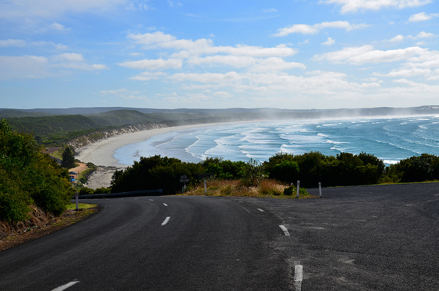
The most visited part of Cape Bridgewater is the 4 km Bridgewater Beach which is patrolled by Portland Surf Life Saving Club during summer. It is commented as one of Australia’s most scenic beaches and Victoria’s best kept secret by voters in RACV 101 must-do survey.
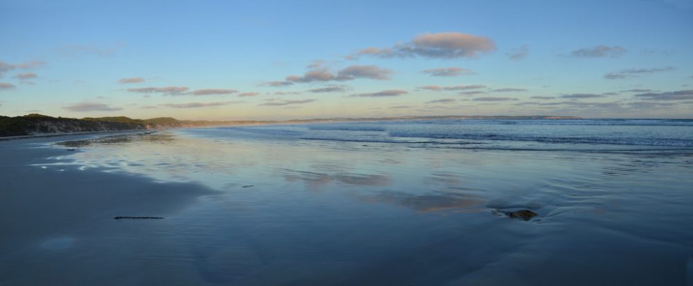
I absolutely agree that the beach is the most spectacular that I have seen, with sand so white, clean and fine that you feel that you are walking on silk. At certain times of the day, particularly at dusk, silvery mists or water vapors appear above the bay giving it an ephemeral, mystical, dreamlike and other-worldly character.
The photo below is the closest to what I have described that was taken one evening on a return trip to Cape Bridgewater. Unfortunately I did not manage to capture any photo or video of the misty bay – you may need to be actually there to experience the ambience.
When we were at the beach, we happened to witness the entire process of a boat being towed back to shore. I have seen boats being hauled out of the water at Altona Boat Ramp but not this so I have recorded the procedure in the video below.
Located on the beach is the Cape Bridgewater Cafe, which is selected in an article by The Age as one of the top 10 cafes along the Great Ocean Road. The author Paul Edwards said: “Worth a visit just for the spectacular setting, 10 minutes beyond Portland. The cafe’s deck almost merges with the beach and has close-up views of Cape Bridgewater and the wide bay.” The cafe used to have live music almost every Sunday afternoon. You can view one here.
Shelly Beach
East of the Bridgewater Beach is the Shelly Beach, an area favoured by rock fishermen and renowned for its variety of shells and hence, it is a great place to collect shells.
Discovery Bay Coastal Park
Cape Bridgewater is part of the 8590-hectare Discovery Bay Coastal Park which constitutes an outstanding sweep of coastline extending westwards for 50 km to Nelson, taking in vast expanses of rolling white sand dunes, sweeping beaches, tranquil lakes and rugged rock formations. These dunes are the largest moving sand dunes in Victoria. They change constantly due to the prevailing winds which sculpture and shape them. The Park has grey kangaroos, red-necked wallabies and over 140 bird species. The Discovery Bay can be accessed by driving along Bridgewater Lakes Rd, then turning left into a dirt road which ends in the Bridgewater Lakes Carpark (GPS coordinates S38.319888, E141.404422).
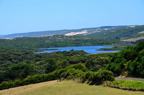
The sand dune in the Discovery Bay is seen as the white area in the photo taken from Bridgewater Lakes Rd shown below. The blue water is one of several Bridgewater Lakes.
There is a walking track that leads from the Bridgewater Lakes Carpark to Discovery Bay. The track ends in this huge sand dune which suddenly appears before you. You will be rewarded by the view after climbing to the top of the steep dune.
Bridgewater Lakes
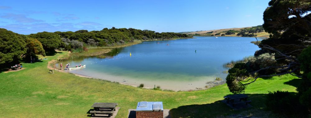
The Bridgewater Lakes are coastal lagoons separated from the sea by sand dunes. They are sheltered and well-suited to picnics, swimming, waterskiing, fishing, canoeing and boating.
Tarragal Caves
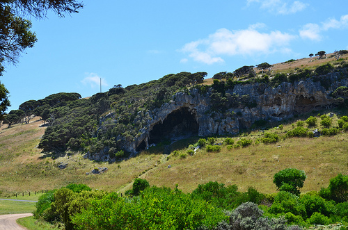
Just directly opposite the dirt road to Bridgewater Lakes are the Tarragal Limestone Caves which are home to many bats and provide excellent views across Discovery Bay. You can park your car at the foot of the hill (GPS coordintes S38.319888, E141.404422) and climb up to the caves.
Other places of interest near Cape Bridgewater which I have not visited include:
- Mount Richmond National Park – an extinct volcano, noted for its wild spring flowers and abundant wildlife.
- Great South West Walk
- Surrey Ridge Picnic Area
- Barrett’s Winery
- Jackass Fern Gully, etc.
Further details can be read here.






Woah! I'm really loving the template/theme of this website. It's simple, yet effective. A lot of times it's difficult to get that "perfect balance" between superb usability and appearance. I must say that you've done a awesome job with this. In addition, the blog loads super quick for me on Opera. Exceptional Blog!
Feel free to visit my page surfboards